
Thank you for supporting this site ❤️
Make a donation
Make a donation
Gear up for your next adventure:
As an Amazon Associate, this site earns from qualifying purchases at no extra cost to you.
Qanag topographic map
Click on the map to display elevation.
Thank you for supporting this site ❤️
Make a donation
Make a donation
Gear up for your next adventure:
As an Amazon Associate, this site earns from qualifying purchases at no extra cost to you.
About this map
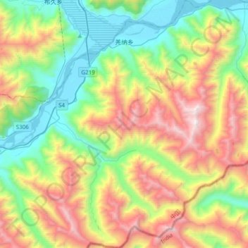
Name: Qanag topographic map, elevation, terrain.
Location: Qanag, Mainling City, Nyingchi Prefecture, Tibet, China (29.20776 94.34981 29.47151 94.62647)
Average elevation: 12,434 ft
Minimum elevation: 9,564 ft
Maximum elevation: 17,388 ft
Thank you for supporting this site ❤️
Make a donation
Make a donation
Gear up for your next adventure:
As an Amazon Associate, this site earns from qualifying purchases at no extra cost to you.