Geolocate

Spring Creek topographic map

Click on the map to display elevation.

👉 Easily get elevation data in JSON, GeoTIFF and KML formats using Elevation API
Thank you for supporting this site ❤️
Make a donation

About this map

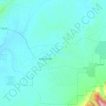
Name: Spring Creek topographic map, elevation, terrain.

Location: Spring Creek, Elko County, Nevada, United States (40.66372 -115.70982 40.82958 -115.48305)

Average elevation: 5,646 ft

Minimum elevation: 5,269 ft

Maximum elevation: 9,304 ft

Elko County trails, hiking, mountain biking, running and outdoor activities

Gear up for your next adventure:

🧥Waterproof Jacket for Hiking - Breathable and rugged rain jacket for outdoor excursions
🌧️Backpack Rain Cover - Keep gear dry in wet weather
📻Weather Alert Radios - Stay informed of storm risks while off-the-grid
🚁Photography Drones - Capture stunning aerial views of landforms and topography
🪶Wildlife Field Guides - Learn animal tracking and species ID

As an Amazon Associate, this site earns from qualifying purchases at no extra cost to you.