
Thank you for supporting this site ❤️
Make a donation
Make a donation
Gear up for your next adventure:
As an Amazon Associate, this site earns from qualifying purchases at no extra cost to you.
Sibulan topographic map
Click on the map to display elevation.
Thank you for supporting this site ❤️
Make a donation
Make a donation
Gear up for your next adventure:
As an Amazon Associate, this site earns from qualifying purchases at no extra cost to you.
About this map
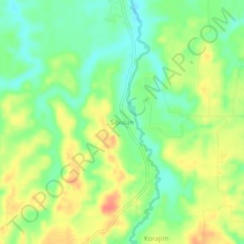
Name: Sibulan topographic map, elevation, terrain.
Location: Sibulan, Serdang Bedagai, North Sumatra, Sumatra, Indonesia (3.22999 99.14042 3.26999 99.18042)
Average elevation: 174 ft
Minimum elevation: 89 ft
Maximum elevation: 276 ft
Thank you for supporting this site ❤️
Make a donation
Make a donation
Gear up for your next adventure:
As an Amazon Associate, this site earns from qualifying purchases at no extra cost to you.