
Thank you for supporting this site ❤️
Make a donation
Make a donation
Gear up for your next adventure:
As an Amazon Associate, this site earns from qualifying purchases at no extra cost to you.
Mebo topographic map
Click on the map to display elevation.
Thank you for supporting this site ❤️
Make a donation
Make a donation
Gear up for your next adventure:
As an Amazon Associate, this site earns from qualifying purchases at no extra cost to you.
About this map
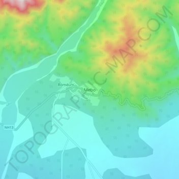
Name: Mebo topographic map, elevation, terrain.
Location: Mebo, Mebo ADC, East Siang, Arunachal Pradesh, India (28.12750 95.38347 28.20750 95.46347)
Average elevation: 1,430 ft
Minimum elevation: 682 ft
Maximum elevation: 4,147 ft
Thank you for supporting this site ❤️
Make a donation
Make a donation
Gear up for your next adventure:
As an Amazon Associate, this site earns from qualifying purchases at no extra cost to you.