Geolocate

Mebo topographic map

Click on the map to display elevation.

About this map

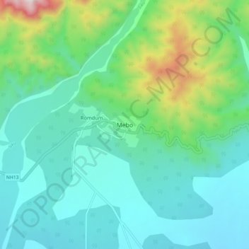
Name: Mebo topographic map, elevation, terrain.

Location: Mebo, Mebo ADC, East Siang, Arunachal Pradesh, India (28.12750 95.38347 28.20750 95.46347)

Average elevation: 1,430 ft

Minimum elevation: 682 ft

Maximum elevation: 4,147 ft

Gear up for your next adventure:

🛌Ultralight Sleeping Bags - Compact down bags for cold nights in the wilderness
🪵Folding Camp Saw - Compact saw for wood and campsite work
🎁Geography Themed Gifts - Unique gift ideas for map lovers and geography enthusiasts
🔭Compact Binoculars - HD vision for scouting terrain and identifying distant landmarks
🎒Trail Energy Bars - High‑calorie bars for hiking energy

As an Amazon Associate, this site earns from qualifying purchases at no extra cost to you.