
Thank you for supporting this site ❤️
Make a donation
Make a donation
Gear up for your next adventure:
As an Amazon Associate, this site earns from qualifying purchases at no extra cost to you.
Maschere topographic map
Click on the map to display elevation.
Thank you for supporting this site ❤️
Make a donation
Make a donation
Gear up for your next adventure:
As an Amazon Associate, this site earns from qualifying purchases at no extra cost to you.
About this map
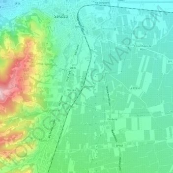
Name: Maschere topographic map, elevation, terrain.
Location: Maschere, Saluzzo, Cuneo, Piedmont, 12037, Italy (44.60829 7.48090 44.64829 7.52090)
Average elevation: 1,270 ft
Minimum elevation: 1,053 ft
Maximum elevation: 1,847 ft
Thank you for supporting this site ❤️
Make a donation
Make a donation
Gear up for your next adventure:
As an Amazon Associate, this site earns from qualifying purchases at no extra cost to you.