
Royal Pines topographic map
Interactive map
Click on the map to display elevation.
Royal Pines
Royal Pines is bordered to the west by U.S. Route 25A and the city limits of Asheville, and to the northeast by Mills Gap Road. Brown Mountain, with an elevation of 2,996 feet (913 m), occupies the center of the CDP.
About this map
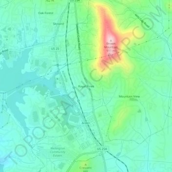
Name: Royal Pines topographic map, elevation, terrain.
Average elevation: 2,297 ft
Minimum elevation: 2,090 ft
Maximum elevation: 2,963 ft
Buncombe County trails, hiking, mountain biking, running and outdoor activities
Other topographic maps
Click on a map to view its topography, its elevation and its terrain.
Beaver Lake
United States > North Carolina > Buncombe County > Asheville > Grace
Average elevation: 2,205 ft