
Thank you for supporting this site ❤️
Make a donation
Make a donation
Gear up for your next adventure:
As an Amazon Associate, this site earns from qualifying purchases at no extra cost to you.
Umapata topographic map
Click on the map to display elevation.
Thank you for supporting this site ❤️
Make a donation
Make a donation
Gear up for your next adventure:
As an Amazon Associate, this site earns from qualifying purchases at no extra cost to you.
About this map
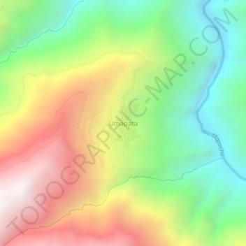
Name: Umapata topographic map, elevation, terrain.
Location: Umapata, Yanatile, Calca, Cusco, Perú (-12.90058 -71.96149 -12.86058 -71.92149)
Average elevation: 8,658 ft
Minimum elevation: 6,112 ft
Maximum elevation: 11,949 ft
Thank you for supporting this site ❤️
Make a donation
Make a donation
Gear up for your next adventure:
As an Amazon Associate, this site earns from qualifying purchases at no extra cost to you.