
Thank you for supporting this site ❤️
Make a donation
Make a donation
Gear up for your next adventure:
As an Amazon Associate, this site earns from qualifying purchases at no extra cost to you.
Kadiyangad topographic map
Click on the map to display elevation.
Thank you for supporting this site ❤️
Make a donation
Make a donation
Gear up for your next adventure:
As an Amazon Associate, this site earns from qualifying purchases at no extra cost to you.
About this map
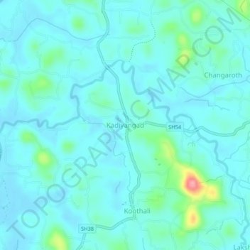
Name: Kadiyangad topographic map, elevation, terrain.
Location: Kadiyangad, Koyilandi, Kozhikode, Kerala, 673525, India (11.57987 75.74459 11.61987 75.78459)
Average elevation: 62 ft
Minimum elevation: 10 ft
Maximum elevation: 367 ft
Thank you for supporting this site ❤️
Make a donation
Make a donation
Gear up for your next adventure:
As an Amazon Associate, this site earns from qualifying purchases at no extra cost to you.
Other topographic maps
Click on a map to view its topography, its elevation and its terrain.
Kinaloor Chitra Mangalam Kshethra Kulam
India > Kerala > Koyilandi > vattoli bazar
Average elevation: 105 ft