Geolocate

Semporna topographic map

Click on the map to display elevation.

About this map

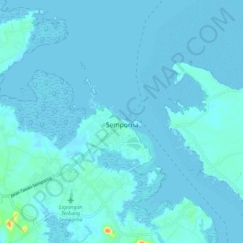
Name: Semporna topographic map, elevation, terrain.

Location: Semporna, Tawau Division, Sabah, 91300, Malaysia (4.43907 118.57188 4.51907 118.65188)

Average elevation: 13 ft

Minimum elevation: -3 ft

Maximum elevation: 351 ft

Gear up for your next adventure:

🛶Inflatable Kayak - Portable kayak for rivers, lakes, and expeditions
📷Action Camera - Capture your outdoor adventures in HD
🧭Map Reading Tools - Tools and kits for map navigation
🏥Hiking First Aid Kits - Comprehensive medical kits for remote trail injuries
🪶Paracord Bracelet - Survival bracelet with built‑in tools

As an Amazon Associate, this site earns from qualifying purchases at no extra cost to you.