Geolocate

Alzey topographic map

Click on the map to display elevation.

About this map

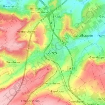
Name: Alzey topographic map, elevation, terrain.

Location: Alzey, Landkreis Alzey-Worms, Rhineland-Palatinate, Germany (49.71895 8.04044 49.77237 8.16632)

Average elevation: 728 ft

Minimum elevation: 489 ft

Maximum elevation: 1,007 ft

Gear up for your next adventure:

👖Convertible Hiking Pants - Versatile zip-off pants for changing altitudes and temperatures
🧴Hand Sanitizer - Keep hands clean while hiking
🩹Survival Bandages - High‑quality bandages for emergencies
🧭Map Reading Tools - Tools and kits for map navigation
🔭Telescopic Hiking Pole - Adjustable pole for hiking stability

As an Amazon Associate, this site earns from qualifying purchases at no extra cost to you.