
Thank you for supporting this site ❤️
Make a donation
Make a donation
Gear up for your next adventure:
As an Amazon Associate, this site earns from qualifying purchases at no extra cost to you.
Mondarello topographic map
Click on the map to display elevation.
Thank you for supporting this site ❤️
Make a donation
Make a donation
Gear up for your next adventure:
As an Amazon Associate, this site earns from qualifying purchases at no extra cost to you.
About this map
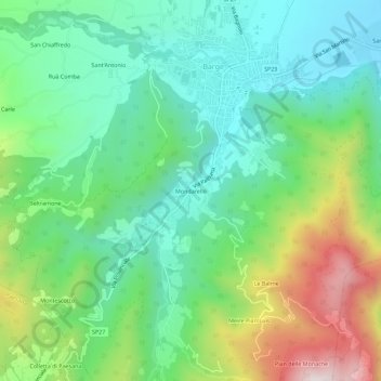
Name: Mondarello topographic map, elevation, terrain.
Location: Mondarello, Barge, Cuneo, Piemonte, 12032, Italia (44.69443 7.29770 44.73443 7.33770)
Average elevation: 1,804 ft
Minimum elevation: 1,050 ft
Maximum elevation: 3,461 ft
Thank you for supporting this site ❤️
Make a donation
Make a donation
Gear up for your next adventure:
As an Amazon Associate, this site earns from qualifying purchases at no extra cost to you.