Gangtok topographic map
Click on the map to display elevation.
Gangtok
Gangtok (Nepali: [gantok] gāntok, Sikkimese: [ɡaŋt̪ʰòk]) is the capital and the most populous city of the Indian state of Sikkim. The seat of eponymous district, Gangtok is in the eastern Himalayan range, at an elevation of 1,650 m (5,410 ft). The city's population of 100,000 consists of the three Sikkimese ethnicities the Bhutias, Lepchas, Nepalis and also plainsmen from other states of India have settled here. Within the higher peaks of the Himalayas and with a year-round mild temperate climate, Gangtok is at the centre of Sikkim's tourism industry.
About this map
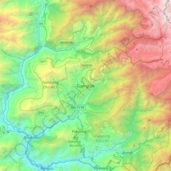
Name: Gangtok topographic map, elevation, terrain.
Location: Gangtok, Sikkim, 737101, India (27.16905 88.45227 27.48905 88.77227)
Average elevation: 6,270 ft
Minimum elevation: 928 ft
Maximum elevation: 17,037 ft
Other topographic maps
Click on a map to view its topography, its elevation and its terrain.