Geolocate

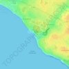
Le Pontreau topographic map

Click on the map to display elevation.

About this map

Name: Le Pontreau topographic map, elevation, terrain.

Location: Le Pontreau, Château-d'Olonne, Les Sables-d'Olonne, Vendée, Pays de la Loire, France métropolitaine, 85180, France (46.46670 -1.77344 46.50670 -1.73344)

Average elevation: 46 ft

Minimum elevation: -3 ft

Maximum elevation: 135 ft

Other topographic maps

Click on a map to view its topography, its elevation and its terrain.
85180

France > Pays de la Loire > Vendée > Les Sables-d'Olonne

Average elevation: 92 ft

85100

France > Pays de la Loire > Vendée > Les Sables-d'Olonne

Average elevation: 16 ft

Gear up for your next adventure:

🦟Ultrasonic Repellers - Create a bug-free zone at your camp or rest stop
🌧️Backpack Rain Cover - Keep gear dry in wet weather
📱Solar Portable Charger - Solar power bank for charging devices off‑grid
❄️Traction Cleats - Prevent slips on icy trails during winter hikes
🌐World Map Poster - Decorative world maps with topographic info

As an Amazon Associate, this site earns from qualifying purchases at no extra cost to you.