
Thank you for supporting this site ❤️
Make a donation
Make a donation
Gear up for your next adventure:
As an Amazon Associate, this site earns from qualifying purchases at no extra cost to you.
Monte Serra topographic map
Click on the map to display elevation.
Thank you for supporting this site ❤️
Make a donation
Make a donation
Gear up for your next adventure:
As an Amazon Associate, this site earns from qualifying purchases at no extra cost to you.
About this map
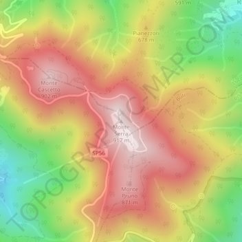
Name: Monte Serra topographic map, elevation, terrain.
Location: Monte Serra, Capannori, Lucca, Toscana, 56011, Italia (43.75100 10.55337 43.75110 10.55347)
Average elevation: 2,041 ft
Minimum elevation: 833 ft
Maximum elevation: 3,015 ft
Thank you for supporting this site ❤️
Make a donation
Make a donation
Gear up for your next adventure:
As an Amazon Associate, this site earns from qualifying purchases at no extra cost to you.
Other topographic maps
Click on a map to view its topography, its elevation and its terrain.
Lago della Gherardesca
Italia > Toscana > Lucca > Capannori > Colle di Compito
Average elevation: 59 ft