
Main Range National Park topographic map
Interactive map
Click on the map to display elevation.
About this map
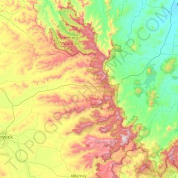
Name: Main Range National Park topographic map, elevation, terrain.
Average elevation: 1,673 ft
Minimum elevation: 161 ft
Maximum elevation: 4,439 ft
Other topographic maps
Click on a map to view its topography, its elevation and its terrain.
Warwick
Australia > Queensland > Warwick
Warwick, Queensland, 4370, Australia
Average elevation: 1,696 ft
Mount Greville
Australia > Queensland > Warwick
Mount Greville, Warwick, Queensland, 4370, Australia
Average elevation: 994 ft