
Thank you for supporting this site ❤️
Make a donation
Make a donation
Gear up for your next adventure:
As an Amazon Associate, this site earns from qualifying purchases at no extra cost to you.
Covanera topographic map
Click on the map to display elevation.
Thank you for supporting this site ❤️
Make a donation
Make a donation
Gear up for your next adventure:
As an Amazon Associate, this site earns from qualifying purchases at no extra cost to you.
About this map
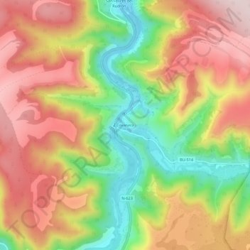
Name: Covanera topographic map, elevation, terrain.
Location: Covanera, Tubilla del Agua, Burgos, Castilla y León, España (42.71387 -3.82172 42.75387 -3.78172)
Average elevation: 2,881 ft
Minimum elevation: 2,231 ft
Maximum elevation: 3,448 ft
Thank you for supporting this site ❤️
Make a donation
Make a donation
Gear up for your next adventure:
As an Amazon Associate, this site earns from qualifying purchases at no extra cost to you.