
Joseph topographic map
Click on the map to display elevation.
About this map
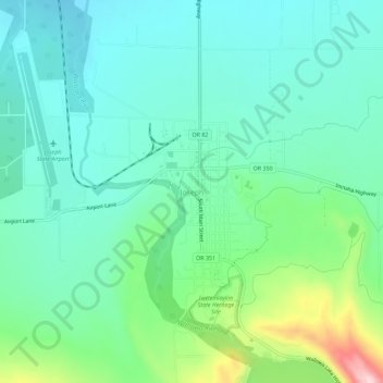
Name: Joseph topographic map, elevation, terrain.
Location: Joseph, Wallowa County, Oregon, 97846, United States (45.33196 -117.25111 45.37196 -117.21111)
Average elevation: 4,213 ft
Minimum elevation: 4,003 ft
Maximum elevation: 4,875 ft
Wallowa County trails, hiking, mountain biking, running and outdoor activities
Other topographic maps
Click on a map to view its topography, its elevation and its terrain.
Hells Canyon National Recreation Area
United States > Oregon > Wallowa County
The Snake River National Recreation Trail #102 (SRNRT) lies within the Hells Canyon National Recreation Area and along the Idaho side of the Snake River, from near Lamont Springs, downstream, to Pittsburg Landing. The SRNRT was designated in 1980 under the National Trails System Act. It was constructed during…
Average elevation: 4,754 ft