
Springhill topographic map
Interactive map
Click on the map to display elevation.
About this map
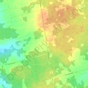
Name: Springhill topographic map, elevation, terrain.
Average elevation: 98 ft
Minimum elevation: 26 ft
Maximum elevation: 151 ft
Other topographic maps
Click on a map to view its topography, its elevation and its terrain.
Inverness
Canada > Prince Edward Island > Rural Municipality of Central Prince > Inverness
Inverness, Rural Municipality of Central Prince, Prince County, Prince Edward Island, Canada
Average elevation: 39 ft