
Kiru topographic map
Click on the map to display elevation.
About this map
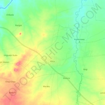
Name: Kiru topographic map, elevation, terrain.
Location: Kiru, Kano State, Nigeria (11.68425 8.10732 11.73647 8.21006)
Average elevation: 1,696 ft
Minimum elevation: 1,581 ft
Maximum elevation: 1,854 ft