Geolocate

Oronoco topographic map

Click on the map to display elevation.

About this map

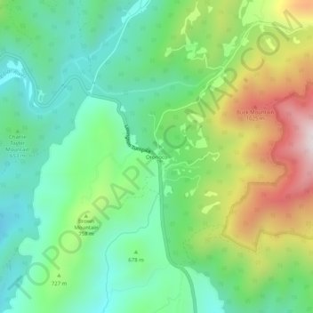
Name: Oronoco topographic map, elevation, terrain.

Location: Oronoco, Amherst County, Virginia, United States (37.71736 -79.27364 37.75736 -79.23364)

Average elevation: 2,260 ft

Minimum elevation: 1,444 ft

Maximum elevation: 3,855 ft

Amherst County trails, hiking, mountain biking, running and outdoor activities

Gear up for your next adventure:

📶Vehicle Signal Boosters - Improve reception in rural areas while driving to trailheads
🛶Inflatable Kayak - Portable kayak for rivers, lakes, and expeditions
🪑Ultralight Camp Chairs - Portable seating for resting after a long day of mapping
🗺️NatGeo Topo Maps - High-quality waterproof printed topographic maps of US Parks
🧯Emergency Survival Kit - All‑in‑one survival essentials for the backcountry

As an Amazon Associate, this site earns from qualifying purchases at no extra cost to you.