
Thank you for supporting this site ❤️
Make a donation
Make a donation
Gear up for your next adventure:
As an Amazon Associate, this site earns from qualifying purchases at no extra cost to you.
Baltacık topographic map
Click on the map to display elevation.
Thank you for supporting this site ❤️
Make a donation
Make a donation
Gear up for your next adventure:
As an Amazon Associate, this site earns from qualifying purchases at no extra cost to you.
About this map
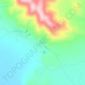
Name: Baltacık topographic map, elevation, terrain.
Location: Baltacık, Panos, Ağrı, Eastern Anatolia Region, Turkey (39.27442 42.80865 39.31442 42.84865)
Average elevation: 5,728 ft
Minimum elevation: 5,354 ft
Maximum elevation: 6,614 ft
Thank you for supporting this site ❤️
Make a donation
Make a donation
Gear up for your next adventure:
As an Amazon Associate, this site earns from qualifying purchases at no extra cost to you.