
Thank you for supporting this site ❤️
Make a donation
Make a donation
Gear up for your next adventure:
As an Amazon Associate, this site earns from qualifying purchases at no extra cost to you.
Stadtlengsfeld topographic map
Click on the map to display elevation.
Thank you for supporting this site ❤️
Make a donation
Make a donation
Gear up for your next adventure:
As an Amazon Associate, this site earns from qualifying purchases at no extra cost to you.
About this map
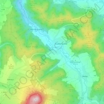
Name: Stadtlengsfeld topographic map, elevation, terrain.
Location: Stadtlengsfeld, Dermbach, Wartburgkreis, Thuringia, Germany (50.74553 10.05962 50.81003 10.16889)
Average elevation: 1,253 ft
Minimum elevation: 801 ft
Maximum elevation: 2,320 ft
Thank you for supporting this site ❤️
Make a donation
Make a donation
Gear up for your next adventure:
As an Amazon Associate, this site earns from qualifying purchases at no extra cost to you.