
Gouwekanaal topographic map
Interactive map
Click on the map to display elevation.
About this map
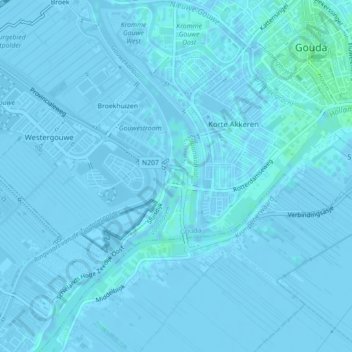
Name: Gouwekanaal topographic map, elevation, terrain.
Location: Gouwekanaal, Gouda, Zuid-Holland, Nederland, 2809NB, Nederland (52.00100 4.69344 52.00215 4.69377)
Average elevation: -3 ft
Minimum elevation: -26 ft
Maximum elevation: 16 ft
Other topographic maps
Click on a map to view its topography, its elevation and its terrain.
Broekhuizen
Nederland > Zuid-Holland > Gouda
Broekhuizen, Gouda, Zuid-Holland, Nederland, 2809 JP, Nederland
Average elevation: -3 ft
Hollandsche IJssel
Nederland > Zuid-Holland > Gouda
Hollandsche IJssel, Gouda, Zuid-Holland, Nederland, 2808PB, Nederland
Average elevation: 0 ft