
Thank you for supporting this site ❤️
Make a donation
Make a donation
Gear up for your next adventure:
As an Amazon Associate, this site earns from qualifying purchases at no extra cost to you.
Paragueda topographic map
Click on the map to display elevation.
Thank you for supporting this site ❤️
Make a donation
Make a donation
Gear up for your next adventure:
As an Amazon Associate, this site earns from qualifying purchases at no extra cost to you.
About this map
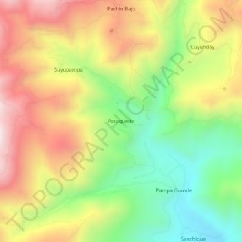
Name: Paragueda topographic map, elevation, terrain.
Location: Paragueda, Otuzco, La Libertad, Perú (-7.92294 -78.64518 -7.88294 -78.60518)
Average elevation: 10,673 ft
Minimum elevation: 9,380 ft
Maximum elevation: 12,103 ft
Thank you for supporting this site ❤️
Make a donation
Make a donation
Gear up for your next adventure:
As an Amazon Associate, this site earns from qualifying purchases at no extra cost to you.