
Thank you for supporting this site ❤️
Make a donation
Make a donation
Gear up for your next adventure:
As an Amazon Associate, this site earns from qualifying purchases at no extra cost to you.
Jinyuan District topographic map
Click on the map to display elevation.
Thank you for supporting this site ❤️
Make a donation
Make a donation
Gear up for your next adventure:
As an Amazon Associate, this site earns from qualifying purchases at no extra cost to you.
About this map
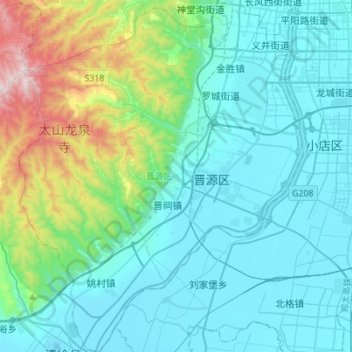
Name: Jinyuan District topographic map, elevation, terrain.
Location: Jinyuan District, Taiyuan City, Shanxi, China (37.60609 112.31901 37.82471 112.54282)
Average elevation: 3,107 ft
Minimum elevation: 2,493 ft
Maximum elevation: 6,070 ft
Thank you for supporting this site ❤️
Make a donation
Make a donation
Gear up for your next adventure:
As an Amazon Associate, this site earns from qualifying purchases at no extra cost to you.