
Thank you for supporting this site ❤️
Make a donation
Make a donation
Gear up for your next adventure:
As an Amazon Associate, this site earns from qualifying purchases at no extra cost to you.
Jebilat topographic map
Click on the map to display elevation.
Thank you for supporting this site ❤️
Make a donation
Make a donation
Gear up for your next adventure:
As an Amazon Associate, this site earns from qualifying purchases at no extra cost to you.
About this map
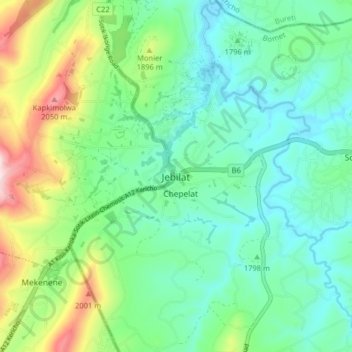
Name: Jebilat topographic map, elevation, terrain.
Location: Jebilat, Sotik, Bomet, Rift Valley, Kenya (-0.73224 35.03267 -0.65224 35.11267)
Average elevation: 5,971 ft
Minimum elevation: 5,627 ft
Maximum elevation: 6,880 ft
Thank you for supporting this site ❤️
Make a donation
Make a donation
Gear up for your next adventure:
As an Amazon Associate, this site earns from qualifying purchases at no extra cost to you.