
Thank you for supporting this site ❤️
Make a donation
Make a donation
Gear up for your next adventure:
As an Amazon Associate, this site earns from qualifying purchases at no extra cost to you.
Llaclla topographic map
Click on the map to display elevation.
Thank you for supporting this site ❤️
Make a donation
Make a donation
Gear up for your next adventure:
As an Amazon Associate, this site earns from qualifying purchases at no extra cost to you.
About this map
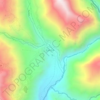
Name: Llaclla topographic map, elevation, terrain.
Location: Llaclla, Abelardo Pardo Lezameta, Bolognesi, Áncash, Perú (-10.31928 -77.16633 -10.27928 -77.12633)
Average elevation: 8,018 ft
Minimum elevation: 6,342 ft
Maximum elevation: 10,348 ft
Thank you for supporting this site ❤️
Make a donation
Make a donation
Gear up for your next adventure:
As an Amazon Associate, this site earns from qualifying purchases at no extra cost to you.