
Thank you for supporting this site ❤️
Make a donation
Make a donation
Gear up for your next adventure:
As an Amazon Associate, this site earns from qualifying purchases at no extra cost to you.
Cumaral topographic map
Click on the map to display elevation.
Thank you for supporting this site ❤️
Make a donation
Make a donation
Gear up for your next adventure:
As an Amazon Associate, this site earns from qualifying purchases at no extra cost to you.
About this map
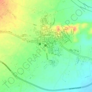
Name: Cumaral topographic map, elevation, terrain.
Location: Cumaral, Piedemonte, Meta, 501021, Colombia (4.25940 -73.49580 4.27629 -73.47658)
Average elevation: 1,335 ft
Minimum elevation: 1,266 ft
Maximum elevation: 1,414 ft
Thank you for supporting this site ❤️
Make a donation
Make a donation
Gear up for your next adventure:
As an Amazon Associate, this site earns from qualifying purchases at no extra cost to you.