Geolocate

Yesa topographic map

Click on the map to display elevation.

About this map

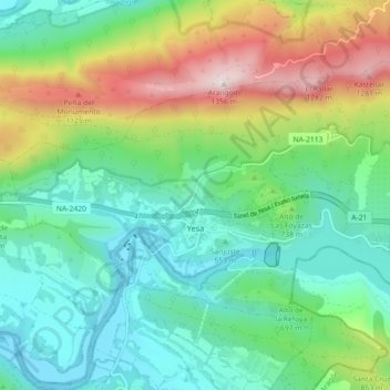
Name: Yesa topographic map, elevation, terrain.

Location: Yesa, Zangozerria, Navarre, Spain (42.60313 -1.24350 42.64851 -1.15382)

Average elevation: 2,264 ft

Minimum elevation: 1,339 ft

Maximum elevation: 4,416 ft

Gear up for your next adventure:

🔭Telescopic Hiking Pole - Adjustable pole for hiking stability
📻Weather Alert Radios - Stay informed of storm risks while off-the-grid
🛏️Cold Weather Sleeping Bag - Warm sleeping bag for cold conditions
🍳Camping Cook Set - Complete cookware for outdoor meals
🧣Hiking Neck Gaiter - Multi‑use neck protection for outdoor weather

As an Amazon Associate, this site earns from qualifying purchases at no extra cost to you.