
Make a donation
Gear up for your next adventure:
As an Amazon Associate, this site earns from qualifying purchases at no extra cost to you.
Todendorf topographic map
Click on the map to display elevation.
Make a donation
Gear up for your next adventure:
As an Amazon Associate, this site earns from qualifying purchases at no extra cost to you.
Todendorf
Todendorf ist ein Ortsteil der im nordöstlichen Teil des Kreises Plön gelegenen Gemeinde Panker. Die Ortschaft befindet sich etwa neun Kilometer nordnordwestlich von Lütjenburg (in dem die Amtsverwaltung der Gemeinde Panker ihren Sitz hat) und liegt auf einer Höhe von 14 m ü. NHN.
Make a donation
Gear up for your next adventure:
As an Amazon Associate, this site earns from qualifying purchases at no extra cost to you.
About this map
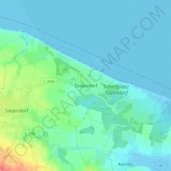
Name: Todendorf topographic map, elevation, terrain.
Average elevation: 33 ft
Minimum elevation: -13 ft
Maximum elevation: 187 ft
Make a donation
Gear up for your next adventure:
As an Amazon Associate, this site earns from qualifying purchases at no extra cost to you.