
Thank you for supporting this site ❤️
Make a donation
Make a donation
Gear up for your next adventure:
As an Amazon Associate, this site earns from qualifying purchases at no extra cost to you.
Montegnée topographic map
Click on the map to display elevation.
Thank you for supporting this site ❤️
Make a donation
Make a donation
Gear up for your next adventure:
As an Amazon Associate, this site earns from qualifying purchases at no extra cost to you.
About this map
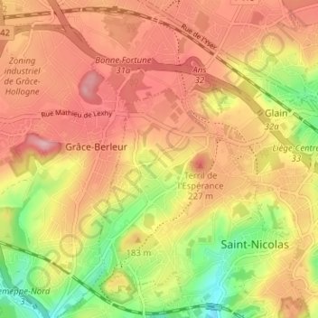
Name: Montegnée topographic map, elevation, terrain.
Location: Montegnée, Saint-Nicolas, Liège, Wallonia, 4420, Belgium (50.62234 5.49861 50.66234 5.53861)
Average elevation: 518 ft
Minimum elevation: 230 ft
Maximum elevation: 722 ft
Thank you for supporting this site ❤️
Make a donation
Make a donation
Gear up for your next adventure:
As an Amazon Associate, this site earns from qualifying purchases at no extra cost to you.