Geolocate

Trespone topographic map

Click on the map to display elevation.

About this map

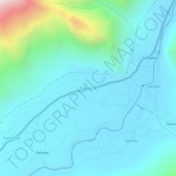
Name: Trespone topographic map, elevation, terrain.

Location: Trespone, Sankoo tehsil, Kargil District, Ladakh, India (34.40016 76.01501 34.44016 76.05501)

Average elevation: 9,931 ft

Minimum elevation: 9,160 ft

Maximum elevation: 14,439 ft

Gear up for your next adventure:

👟Men's Trail Runners - Lightweight footwear for fast-paced exploration and light hiking
🏕️Tent Footprint - Protect your tent base from wear
🚁Photography Drones - Capture stunning aerial views of landforms and topography
🪵Folding Camp Saw - Compact saw for wood and campsite work
🩳Quick‑Dry Hiking Shorts - Comfortable and quick‑dry shorts for summer hiking

As an Amazon Associate, this site earns from qualifying purchases at no extra cost to you.