
Bellur topographic map
Interactive map
Click on the map to display elevation.
About this map
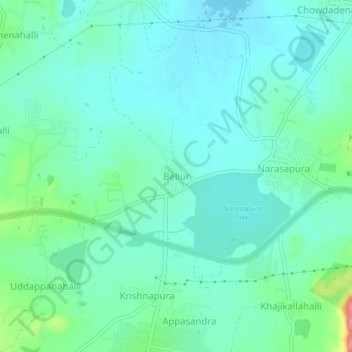
Name: Bellur topographic map, elevation, terrain.
Location: Bellur, Kolar taluk, Kolar District, Karnataka, 563133, India (13.11733 77.97185 13.15733 78.01185)
Average elevation: 2,867 ft
Minimum elevation: 2,802 ft
Maximum elevation: 3,107 ft
Other topographic maps
Click on a map to view its topography, its elevation and its terrain.
Challahalli
India > Karnataka > Kolar taluk
Challahalli, Kolar taluk, Kolar District, Karnataka, 563102, India
Average elevation: 2,976 ft
Siresandra
India > Karnataka > Kolar taluk
Siresandra, Kolar taluk, Kolar district, Karnataka, India
Average elevation: 2,608 ft
Kolar
India > Karnataka > Kolar taluk
Kolar, Kolar taluk, Kolar district, Karnataka, 563101, India
Average elevation: 2,779 ft