Geolocate

Hooper topographic map

Click on the map to display elevation.

About this map

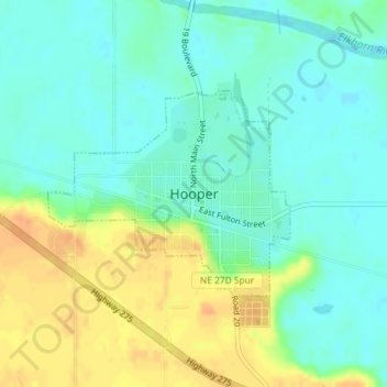
Name: Hooper topographic map, elevation, terrain.

Location: Hooper, Dodge County, Nebraska, United States (41.60454 -96.56134 41.61887 -96.53871)

Average elevation: 1,250 ft

Minimum elevation: 1,207 ft

Maximum elevation: 1,319 ft

Dodge County trails, hiking, mountain biking, running and outdoor activities

Gear up for your next adventure:

🩹Survival Bandages - High‑quality bandages for emergencies
❄️Traction Cleats - Prevent slips on icy trails during winter hikes
🚪Portable Camp Chair - Foldable chair for comfort at camp
🧢Sun Protection Hats - Wide-brimmed and UPF-rated hats for high-altitude sun safety
👖Convertible Hiking Pants - Versatile zip-off pants for changing altitudes and temperatures

As an Amazon Associate, this site earns from qualifying purchases at no extra cost to you.