Geolocate

Parna topographic map

Click on the map to display elevation.

About this map

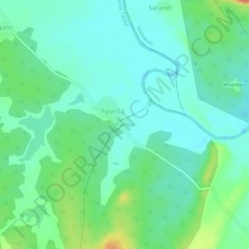
Name: Parna topographic map, elevation, terrain.

Location: Parna, Sindewahi, Chandrapur District, Maharashtra, India (20.32624 79.46353 20.36624 79.50353)

Average elevation: 728 ft

Minimum elevation: 669 ft

Maximum elevation: 896 ft

Gear up for your next adventure:

🎒Day Hiking Backpack - Lightweight backpack perfect for day trips and outdoor adventures
🛰️Satellite Messengers - Emergency SOS and two-way messaging for off-grid adventures
📡Handheld GPS Device - Reliable handheld GPS for outdoor navigation
🧭Hiking Compass - Precision compass for reliable navigation in the wilderness
🗃️Trail First Aid Kit - Essential kit for outdoor injuries and emergencies

As an Amazon Associate, this site earns from qualifying purchases at no extra cost to you.