Geolocate

Sperry topographic map

Click on the map to display elevation.

About this map

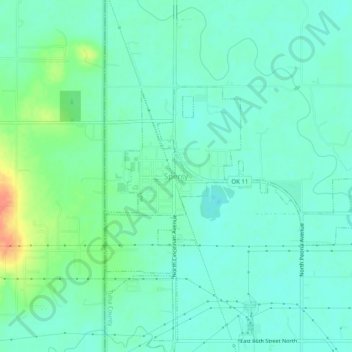
Name: Sperry topographic map, elevation, terrain.

Location: Sperry, Tulsa County, Oklahoma, 74073, United States (36.27731 -96.01139 36.31731 -95.97139)

Average elevation: 627 ft

Minimum elevation: 587 ft

Maximum elevation: 741 ft

Tulsa County trails, hiking, mountain biking, running and outdoor activities

Other topographic maps

Click on a map to view its topography, its elevation and its terrain.

Oakhurst

United States > Oklahoma > Tulsa County

Average elevation: 748 ft

Audobon Park

United States > Oklahoma > Tulsa County > Tulsa

Average elevation: 705 ft

Wellington South

United States > Oklahoma > Tulsa County > Tulsa

Average elevation: 676 ft

Sperry

United States > Oklahoma > Tulsa County > Sperry

Average elevation: 617 ft

Terrace Park

United States > Oklahoma > Tulsa County > Tulsa

Average elevation: 735 ft

Turley

United States > Oklahoma > Tulsa County

Average elevation: 656 ft

Gear up for your next adventure:

🪑Portable Camp Table - Compact table for campsite meals
🔭Stargazing Telescopes - Perfect for camping in low-light pollution areas shown on maps
🥤Water Filter Bottle - All‑in‑one filter bottle for safe hydration
🏕️Tent Footprint - Protect your tent base from wear
🏔️Mountain Trail Maps - High‑detail maps for popular peaks

As an Amazon Associate, this site earns from qualifying purchases at no extra cost to you.