Geolocate

Noonday topographic map

Click on the map to display elevation.

About this map

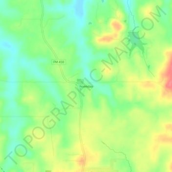
Name: Noonday topographic map, elevation, terrain.

Location: Noonday, Harrison County, Texas, 75650, United States (32.53404 -94.60826 32.57404 -94.56826)

Average elevation: 354 ft

Minimum elevation: 253 ft

Maximum elevation: 489 ft

Harrison County trails, hiking, mountain biking, running and outdoor activities

Other topographic maps

Click on a map to view its topography, its elevation and its terrain.

Waskom

United States > Texas > Harrison County

Average elevation: 272 ft

Hallsville

United States > Texas > Harrison County

Average elevation: 367 ft

Nesbitt

United States > Texas > Harrison County

Average elevation: 371 ft

Gear up for your next adventure:

💧Water Filtration Bottles - Safely drink from streams and lakes while exploring
🦶Hiking Gaiters - Keep debris and water out of your boots
🪶Compact Camp Shovel - Folding shovel for campsite tasks
📶Satellite Messenger - Communication device off‑grid
🔦Powerful Headlamps - Ultra-bright hands-free lighting for night navigation

As an Amazon Associate, this site earns from qualifying purchases at no extra cost to you.