
Thank you for supporting this site ❤️
Make a donation
Make a donation
Gear up for your next adventure:
As an Amazon Associate, this site earns from qualifying purchases at no extra cost to you.
Puetaqui topographic map
Click on the map to display elevation.
Thank you for supporting this site ❤️
Make a donation
Make a donation
Gear up for your next adventure:
As an Amazon Associate, this site earns from qualifying purchases at no extra cost to you.
About this map
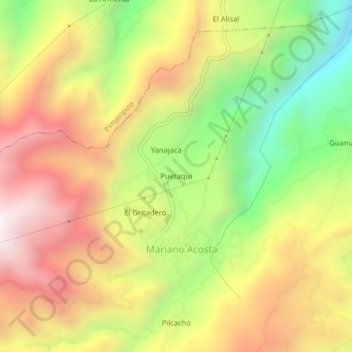
Name: Puetaqui topographic map, elevation, terrain.
Location: Puetaqui, Mariano Acosta, Pimampiro, Imbabura, Ecuador (0.28493 -78.00356 0.32493 -77.96356)
Average elevation: 10,056 ft
Minimum elevation: 7,956 ft
Maximum elevation: 12,041 ft
Thank you for supporting this site ❤️
Make a donation
Make a donation
Gear up for your next adventure:
As an Amazon Associate, this site earns from qualifying purchases at no extra cost to you.
Other topographic maps
Click on a map to view its topography, its elevation and its terrain.