
Make a donation
Gear up for your next adventure:
As an Amazon Associate, this site earns from qualifying purchases at no extra cost to you.
Anjar topographic map
Click on the map to display elevation.
Make a donation
Gear up for your next adventure:
As an Amazon Associate, this site earns from qualifying purchases at no extra cost to you.
About this map
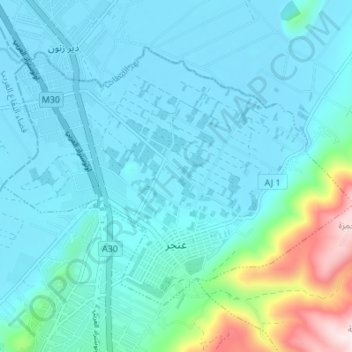
Name: Anjar topographic map, elevation, terrain.
Location: Anjar, Zahlé District, Beqaa Governorate, Lebanon (33.71847 35.89766 33.76025 35.96602)
Average elevation: 3,107 ft
Minimum elevation: 2,844 ft
Maximum elevation: 4,646 ft
Make a donation
Gear up for your next adventure:
As an Amazon Associate, this site earns from qualifying purchases at no extra cost to you.
Other topographic maps
Click on a map to view its topography, its elevation and its terrain.
Kfar Mishki
Kfarmishki, also spelled Kfar Mishki or Kfar Mechki (Arabic: كفرمشكي), is a small mountain authority in the Rashaya District of the Beqaa Governate in Lebanon. This village is located approximately 92 km southeast of Beirut and lies at an altitude of 950–1350 m above sea level on the western slope of…
Average elevation: 3,422 ft
Make a donation
Gear up for your next adventure:
As an Amazon Associate, this site earns from qualifying purchases at no extra cost to you.