Geolocate

Acli topographic map

Click on the map to display elevation.

About this map

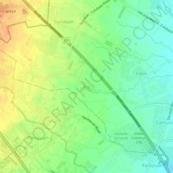
Name: Acli topographic map, elevation, terrain.

Location: Acli, Mexico, Pampanga, Central Luzon, 1992, Philippines (15.10315 120.62485 15.14315 120.66485)

Average elevation: 157 ft

Minimum elevation: 98 ft

Maximum elevation: 220 ft

Other topographic maps

Click on a map to view its topography, its elevation and its terrain.

Masamat

Philippines > Pampanga > Mexico

Average elevation: 23 ft

Gear up for your next adventure:

👟Trail Running Shoes - Lightweight shoes for trail runners
🎒Outdoor Daypacks - Lightweight backpacks designed for carrying maps and essential gear
🔥Camping Stove - Portable stove for camping and backcountry cooking
🔌USB Car Charger - Car charger for on‑the‑go power needs
🛰️Handheld GPS Units - Professional satellite navigators for precise backcountry mapping

As an Amazon Associate, this site earns from qualifying purchases at no extra cost to you.