
Thank you for supporting this site ❤️
Make a donation
Make a donation
Gear up for your next adventure:
As an Amazon Associate, this site earns from qualifying purchases at no extra cost to you.
Chiodo topographic map
Click on the map to display elevation.
Thank you for supporting this site ❤️
Make a donation
Make a donation
Gear up for your next adventure:
As an Amazon Associate, this site earns from qualifying purchases at no extra cost to you.
About this map
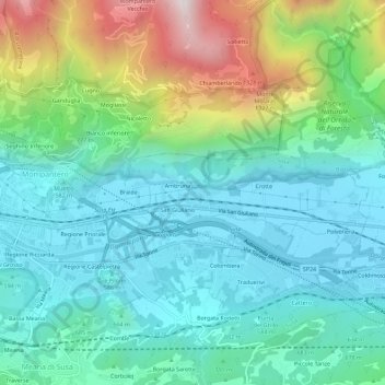
Name: Chiodo topographic map, elevation, terrain.
Location: Chiodo, Susa, Torino, Piemonte, 10050, Italia (45.12012 7.06616 45.16012 7.10616)
Average elevation: 2,428 ft
Minimum elevation: 1,476 ft
Maximum elevation: 5,194 ft
Thank you for supporting this site ❤️
Make a donation
Make a donation
Gear up for your next adventure:
As an Amazon Associate, this site earns from qualifying purchases at no extra cost to you.