Geolocate

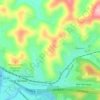
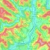
Wallace topographic map

Click on the map to display elevation.

About this map

Name: Wallace topographic map, elevation, terrain.

Location: Wallace, Harrison County, West Virginia, 26448, United States (39.38953 -80.50981 39.42953 -80.46981)

Average elevation: 1,220 ft

Minimum elevation: 978 ft

Maximum elevation: 1,539 ft

Harrison County trails, hiking, mountain biking, running and outdoor activities

Other topographic maps

Click on a map to view its topography, its elevation and its terrain.
Enterprise

United States > West Virginia > Harrison County

Average elevation: 1,109 ft

Despard

United States > West Virginia > Harrison County

Average elevation: 1,175 ft

Anmoore

United States > West Virginia > Harrison County

Average elevation: 1,161 ft

Shinnston

United States > West Virginia > Harrison County

Average elevation: 1,066 ft

Lost Creek

United States > West Virginia > Harrison County

Average elevation: 1,168 ft

Gear up for your next adventure:

🎒Waterproof Dry Bags - Keep your electronics and maps dry inside your pack
🪶Camp Gear Gift Set - Perfect gift bundle for outdoor fans
🧭Compass with Lanyard - Easy‑carry compass for navigation
🥾Men's Hiking Boots - Durable, waterproof footwear for rugged terrain and steep inclines
🕶️GPS Smartphone Mount - Secure mount for phone navigation

As an Amazon Associate, this site earns from qualifying purchases at no extra cost to you.