
Thank you for supporting this site ❤️
Make a donation
Make a donation
Gear up for your next adventure:
As an Amazon Associate, this site earns from qualifying purchases at no extra cost to you.
Kelageri topographic map
Click on the map to display elevation.
Thank you for supporting this site ❤️
Make a donation
Make a donation
Gear up for your next adventure:
As an Amazon Associate, this site earns from qualifying purchases at no extra cost to you.
About this map
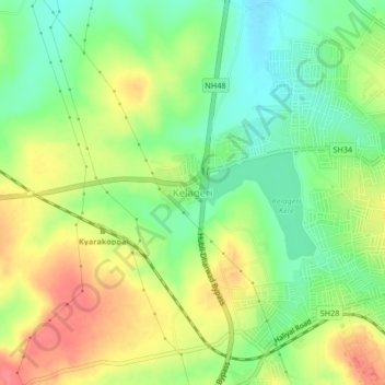
Name: Kelageri topographic map, elevation, terrain.
Location: Kelageri, Dharawada taluku, Dharwad, Karnataka, 580110, India (15.43915 74.94555 15.47915 74.98555)
Average elevation: 2,343 ft
Minimum elevation: 2,238 ft
Maximum elevation: 2,464 ft
Thank you for supporting this site ❤️
Make a donation
Make a donation
Gear up for your next adventure:
As an Amazon Associate, this site earns from qualifying purchases at no extra cost to you.