
Thank you for supporting this site ❤️
Make a donation
Make a donation
Gear up for your next adventure:
As an Amazon Associate, this site earns from qualifying purchases at no extra cost to you.
Mexcalcuautla topographic map
Click on the map to display elevation.
Thank you for supporting this site ❤️
Make a donation
Make a donation
Gear up for your next adventure:
As an Amazon Associate, this site earns from qualifying purchases at no extra cost to you.
About this map
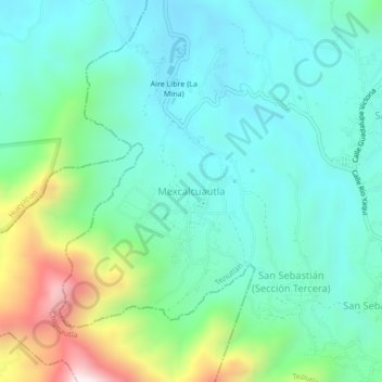
Name: Mexcalcuautla topographic map, elevation, terrain.
Location: Mexcalcuautla, Teziutlán, Puebla, 73967, México (19.84833 -97.41222 19.88833 -97.37222)
Average elevation: 5,738 ft
Minimum elevation: 5,069 ft
Maximum elevation: 7,805 ft
Thank you for supporting this site ❤️
Make a donation
Make a donation
Gear up for your next adventure:
As an Amazon Associate, this site earns from qualifying purchases at no extra cost to you.