
Thank you for supporting this site ❤️
Make a donation
Make a donation
Gear up for your next adventure:
As an Amazon Associate, this site earns from qualifying purchases at no extra cost to you.
Uxmal topographic map
Click on the map to display elevation.
Thank you for supporting this site ❤️
Make a donation
Make a donation
Gear up for your next adventure:
As an Amazon Associate, this site earns from qualifying purchases at no extra cost to you.
About this map
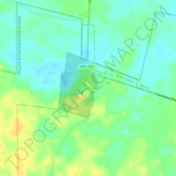
Name: Uxmal topographic map, elevation, terrain.
Location: Uxmal, Santa Elena, Yucatán, 97890, Mexico (20.34029 -89.79056 20.38029 -89.75056)
Average elevation: 167 ft
Minimum elevation: 131 ft
Maximum elevation: 220 ft
Thank you for supporting this site ❤️
Make a donation
Make a donation
Gear up for your next adventure:
As an Amazon Associate, this site earns from qualifying purchases at no extra cost to you.