Geolocate

Hailsham topographic map

Click on the map to display elevation.

About this map

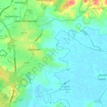
Name: Hailsham topographic map, elevation, terrain.

Location: Hailsham, Wealden, East Sussex, England, United Kingdom (50.83609 0.23526 50.88954 0.30873)

Average elevation: 46 ft

Minimum elevation: -3 ft

Maximum elevation: 190 ft

Gear up for your next adventure:

🌐World Map Poster - Decorative world maps with topographic info
🔋Rechargeable Batteries - Power up your outdoor devices
🛠️Backpacking Tool Kit - Essential toolkit for outdoor repairs
🔌USB Car Charger - Car charger for on‑the‑go power needs
🛡️Insect Repellent - Protection against bugs during outdoor activities

As an Amazon Associate, this site earns from qualifying purchases at no extra cost to you.