Geolocate

Swan Reach topographic map

Click on the map to display elevation.

About this map
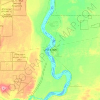
Name: Swan Reach topographic map, elevation, terrain.

Location: Swan Reach, Mid Murray Council, South Australia, 5354, Australia (-34.66052 139.43809 -34.47645 139.75888)

Average elevation: 184 ft

Minimum elevation: -10 ft

Maximum elevation: 502 ft

Other topographic maps

Click on a map to view its topography, its elevation and its terrain.
Black Hill

Australia > South Australia > Mid Murray Council > Truro

Average elevation: 1,220 ft

Gear up for your next adventure:

🪓Survival Multi‑Tool - Versatile tool for camp and trail tasks
🔥Plasma Lighters - Windproof lighters that work in any weather condition
🧭GPS Watch Accessories - Bands and chargers for GPS watches
⛑️Personal Locator Beacon - Safety beacon for emergencies
🏕️Family Camping Gear - Essentials for group camping trips

As an Amazon Associate, this site earns from qualifying purchases at no extra cost to you.