
Thank you for supporting this site ❤️
Make a donation
Make a donation
Gear up for your next adventure:
As an Amazon Associate, this site earns from qualifying purchases at no extra cost to you.
After topographic map
Click on the map to display elevation.
Thank you for supporting this site ❤️
Make a donation
Make a donation
Gear up for your next adventure:
As an Amazon Associate, this site earns from qualifying purchases at no extra cost to you.
About this map
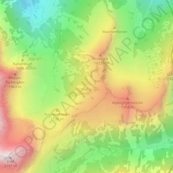
Name: After topographic map, elevation, terrain.
Location: After, Glarus Nord, Glarus, 8874, Switzerland (47.07050 9.15929 47.09050 9.17929)
Average elevation: 5,361 ft
Minimum elevation: 3,661 ft
Maximum elevation: 7,267 ft
Thank you for supporting this site ❤️
Make a donation
Make a donation
Gear up for your next adventure:
As an Amazon Associate, this site earns from qualifying purchases at no extra cost to you.