
Thank you for supporting this site ❤️
Make a donation
Make a donation
Gear up for your next adventure:
As an Amazon Associate, this site earns from qualifying purchases at no extra cost to you.
Dedem topographic map
Click on the map to display elevation.
Thank you for supporting this site ❤️
Make a donation
Make a donation
Gear up for your next adventure:
As an Amazon Associate, this site earns from qualifying purchases at no extra cost to you.
About this map
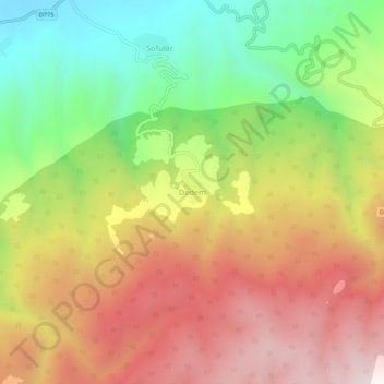
Name: Dedem topographic map, elevation, terrain.
Location: Dedem, Tosya, Kastamonu, Black Sea Region, Turkey (40.95666 34.13781 40.99666 34.17781)
Average elevation: 3,448 ft
Minimum elevation: 1,706 ft
Maximum elevation: 5,200 ft
Thank you for supporting this site ❤️
Make a donation
Make a donation
Gear up for your next adventure:
As an Amazon Associate, this site earns from qualifying purchases at no extra cost to you.